Blog Categories
Most popular blog posts
Like this Blog
Latest blog posts
Latest blog comments
Most active Bloggers
Categories
|
|
by Linus
12.05.2015 05:26
|
|
..::BERLIN::..
UNWETTERLAGE: Am Dienstag sind GEWITTER zu erwarten. Diese können teils auch UNWETTERARTIG ausfallen, also die Kriterien des Warnzentrums des Deutschen Wetterdienstes Erfüllen um als signifikante Bedrohung für Menschenleben und Dinge zu gelten. In den GEWITTERN am Dienstag besteht eine im Vergleich zu normalen GEWITTERN eine erhöhte GEFAHR vor TORNADOS. Dass es auch in Deutschland Tornados gibt, wurde schon vorige Woche am Dienstag bestätigt, als insgesamt bis zu sieben Tornados zugeschlagen haben und unter anderem Bützow (nahe Rostock) verwüstet haben. Es besteht eine Moderate GEFAHR vor EXTREMEN UNWETTERN. Auch STARKREGEN bis 60l/m² (dabei SCHLECHTE SICHT!) ist möglich. Zudem sind HAGEL bis 7cm im Durchmesser und ORKANBÖEN über 120km/h sind möglich. Bitte beachten sie, dass „möglich“ nicht mit „wahrscheinlich“ oder „zu erwarten“ gleichzustellen ist – dies sind allerdings alles Möglichkeiten.
THUNDERSTORM SITUATION: On Tuesday THUNDERSTORMS are to be expected. These can also be partly SEVERE, meaning that they fulfill the criteria of the warning center of the German Weather Service to be considered a significant threat to human life and objects. In the THUNDERSTORMS on Tuesday, compared to normal THUNDERSTORMS, there is an increased risk of TORNADOS. That there are also Tornados in Germany was proven last week, when a total of up to seven Tornados struck and, amongst other damage, destroyed the town Bützow (near Rostock). There is a moderate RISK of EXTREME THUNDERSTORMS. Also STRONG RAIN up to 60l/m² (then BAD VISIBILITY!) is possible. More, HAIL up to 7cm in diameter and HURRICANE-FORCED GUSTS over 120km/h are possible. Please note that “possible” is not the same as “likely” or “to be expected” - but all are possibilities.
|
|
by Linus
30.04.2015 05:27
|
|

GEWITTERLAGE: Am Donnerstag sind am Nachmittag GEWITTER vorhergesagt. Diese werden von einer Okklusion (Wetterfront) ausgelöst. Zum teil können die GEWITTER ORGANISIERT (also besser strukturiert und somit auch gefährlicher) sein. Gefahren sind zum Beispiel STARKREGEN von bis zu 30l/m² aber auch HAGEL mit bis zu 3cm Durchmesser. Die meisten GEWITTER werden sich wahrscheinlich aus Südwesten heran bewegen. Besonders STARKE GEWITTER (SUPERZELLEN) können sich auch anders bewegen! Auch STURMBÖEN sind möglich, allerdings nicht so wahrscheinlich. Bei SUPERZELLENGEWITTERN gibt es auch eine im Vergleich erhöhte Gefahr vor TORNADOS.
THUNDERSTORM SITUATION: On Thursday THUNDERSTORMS are predicted in the afternoon. These will be caused by an occlusion (a weather front). Some of the THUNDERSTORMS can be ORGANIZED (so better structured and therefore more dangerous). Danger for example are STRONG RAIN up to 30l/m² but also HAIL with diameters up to 3c. Most THUNDERSTORMS will probably come from the southwest. Very STRONG THUNDERSTORMS (SUPERCELLS) can also move differently! Also STORM GUSTS are possible, however not so likely. In SUPERCELL THUNDERSTORMS there is also, compared to other THUNDERSTORMS, an increased risk of TORNADOS.
|
|
by Linus
30.04.2015 05:10
|
|
GEWITTERLAGE: Am Donnerstag sind am Nachmittag GEWITTER vorhergesagt. Diese werden von einer Okklusion (Wetterfront) ausgelöst. Zum teil können die GEWITTER ORGANISIERT (also besser strukturiert und somit auch gefährlicher) sein. Gefahren sind zum Beispiel STARKREGEN von bis zu 30l/m² aber auch HAGEL mit bis zu 3cm Durchmesser. Die meisten GEWITTER werden sich wahrscheinlich aus Südwesten heran bewegen. Besonders STARKE GEWITTER (SUPERZELLEN) können sich auch anders bewegen! Auch STURMBÖEN sind möglich, allerdings nicht so wahrscheinlich. Bei SUPERZELLENGEWITTERN gibt es auch eine im Vergleich erhöhte Gefahr vor TORNADOS.
THUNDERSTORM SITUATION: On Thursday THUNDERSTORMS are predicted in the afternoon. These will be caused by an occlusion (a weather front). Some of the THUNDERSTORMS can be ORGANIZED (so better structured and therefore more dangerous). Danger for example are STRONG RAIN up to 30l/m² but also HAIL with diameters up to 3c. Most THUNDERSTORMS will probably come from the southwest. Very STRONG THUNDERSTORMS (SUPERCELLS) can also move differently! Also STORM GUSTS are possible, however not so likely. In SUPERCELL THUNDERSTORMS there is also, compared to other THUNDERSTORMS, an increased risk of TORNADOS.
|
|
by Linus
26.04.2015 13:45
|
|
Caution - thunderstorms in Europe!
|
|
by Linus
13.04.2015 06:54
|
|
Newest observations have shown that the cold front of low “Stefan” is STRONGER THAN EXPECTED. Peak gusts near 90km/h can be expected. In the forecast for Berlin / Potsdam 60km/h were forecast – with this message, the forecast peak gust value is raised to 90km/h. Please be very cautious when you are outside!
M.I.L.K. Skywatch / Weather
www.milk-weather.org
www.milk-stormchasers.de
|
|
by Linus
06.04.2015 12:21
|
|
Heute (Nachmittag) besteht eine geringe Gefahr vor Gewitter in Österreich, vor allem dem Norden. Hauptgefahren dabei sind Schnee und Graupelschauer oder Hagelschauer sowie Sturmböen. Auch Starkregen ist möglich. Besonders in der Mitte Österreichs ist auch ein vereinzelter Tornado nicht auszuschließen.
Today (afternoon) there is a slight risk of thunderstorms in Austria, especially in the north. Main risks in these systems are snow and sleet, as well as hail showers and storm gusts. Also strong rain is possible. Especially in the middle of Austria a local tornado event cannot be excluded.

|
|
by Linus
02.04.2015 21:11
|
|
Die extremsten prognostizierten Werte der Welt aus über 2,700 Städten
The most extreme forecast values in the world from over 2,700 cities
2015.04.03
Stärkste Böen / Highest wind peaks:
- 104km/h (Wajima, JAP)
- 100km/h (Akita, JAP)
- 99km/h (Alto Rio Senguer, ARG)
24h Niederschlag / 24h Precipitation:
- 81.4mm (Luisville, USA)
- 68mm (Erimomisaki, JAP)
24h Schneefall / 24h snowfall:
- 39cm (Yamunotri, IND)
- 22cm (Angmagssalik, GRÖ)
- 19cm (Patreksflördur, ISL)
Hitze / Heat:
- 48°C (Kolda, SEN)
- 47°C (Kedougou, SEN)
- 45°C (Kita, MLI)
Kälte / Cold
- -25°C (Kotzebue, USA)
- -25°C (Kühtai, AUT)
- -25°C (Casey, ANT)
Eisregen / Freezing Rain
- 3mm (Kingston, CAN)
- 2mm (Charlottetown, CAN)
- 2mm (Caribou, CAN)
Schwüle / Dampness (in combination with heat)
Dampfdruck / hPa of water vapor:
- 35hPa (Sorong, INDO)
- 34hPa (Broome, AUS)
- 34hPa (Merauke, INDO)
|
|
by Linus
02.04.2015 09:13
|
|
Austria: Severe storm
Bosnia and Herzegowina: No Warnings
Belgium: No Warnings
Bulgaria: No Warnings
Switzerland: Strong wind, strong winter weather
Cyprus: No Warnings
Czech Republic: Severe winter weather, strong wind
Germany: Severe storm, strong winter weather, strong cold
Denmark: No Warnings
Estonia: No Warnings
Spain: Strong waves, strong wind
Finland: No Warnings
France: Increased risk of avalanches, flooding
Greece: No Warnings
Croatia: Strong wind
Hungary: Strong wind, strong thunderstorms
Ireland: No Warnings
Iceland: No Warnings
Italy: Strong wind
Luxembourg: No Warnings
Latvia: No Warnings
Montenegro: Severe storm
Macedonia: No Warnings
Malta: Strong waves
Netherlands: Strong wind
Norway: No Warnings
Poland: Strong winter weasther+
Portugal: No Warnings
Romania: No Warnigns
Serbia: No Warnings
Sweden: No Warnings
Slovenia: Strong wind
Slovakia: Strong winter weather, strong wind
UK: No Warning
|
|
by Linus
31.03.2015 06:50
|
|
M.I.L.K. WARNING regarding HURRICANE-FORCED GUSTS
For Berlin and Surrounding
Valid from: 31.03.2015, 12:00CEST
until: 01.04.2015, 20:00CEST
Issued by M.I.L.K. Weather
at: 31.03.2015, 06:45CEST
Peak: 31.03.2015, 20:00CEST
For the entire duration of the warning, storm gusts are to be expected. In the afternoon and evening hours, near hurricane-forced gusts to 110km/h are expected, and, especially close to showers, hurricane-forced gusts are possible (up to 120km/h), too.
Notice: An increase in intensity is possible.
CAUTION! Trees can be toppled and roofs damaged. Watch out for falling branches, roof shingles or other objects.
Keep yourself updated on www.milk-weather.org, www.milk-stormchasers.de as well as your local weather service (DWD, Deutscher Wetterdienst).
M.I.L.K. Skywatch, a part of M.I.l.K. Weather ////// Station 10001, Berlin Steglitz.
|
|
by Linus
30.03.2015 07:45
|
|
There are still storm gusts in Germany.
There are currently several thunderstorm systems underway in Germany, circled in the radar image below.

|
|
by Linus
29.03.2015 20:45
|
|

[img]/http://files.homepagemodules.de/b576829/f86t1289p2381n3_MvfEqodP.png[img]

|
|
by Linus
29.03.2015 20:34
|
|
The cold front of storm "MIKE" has reached Germany with storm gusts and severe thunderstorms. If necessary, updates will follow.
|
|
by Alexis
27.03.2015 11:48
|
|

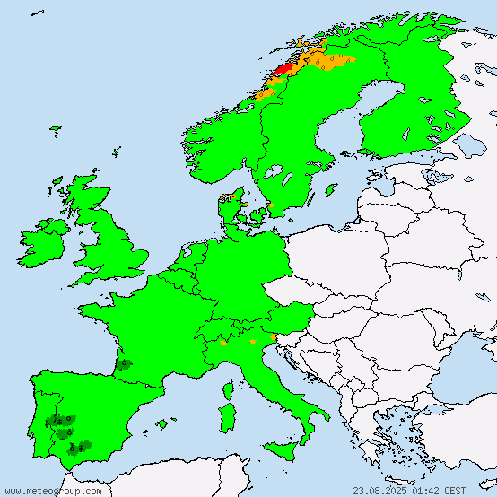
Green: no warning
Yellow: Strong weather
orange: severe weather
|
|
by Alexis
27.03.2015 11:31
|
|

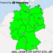
Green: no warning
Yellow: Strong weather
|
|
by Linus
27.03.2015 05:24
|
|
Austria: Strong wind, thunderstorms
Bosnia and Herzegowina: Strong rain, strong wind
Belgium: No warnings
Bulgaria: Severe rain
Switzerland: Strong wind
Cyprus: No warnings
Czech republic: No warnings
Germany: Fog, winter weather, strong wind
Denmark: No warnings
Estonia: Strong wind
Spain: Storm and strong waves
Finland: N/A
France: Strong wind, avalanches
Greece: Thunderstorms, strong rain
Croatia: Strong wind
Hungary: Strong wind
Ireland: No warnings
Iceland: No warnings
Italy: Storm, severe thunderstorms, severe rain
Luxembourg: No warnings
Latvia: Strong wind
Montenegro: No warnings
Macedonia: Strong rain, thunderstorms
Malta: Strong waves, strong wind
Netherlands: Strong wind
Norway: Strong wind
Poland: Fog
Portugal: No warnings
Romania: No warnings
Serbia: Strong rain
Sweden: Winter weather, strong waves
Slovenia: Avalanches, strong wind
Slovakia: Strong wind
UK: No warnings
|
|